Spring Flooding
Spring Flooding
Phenomenon
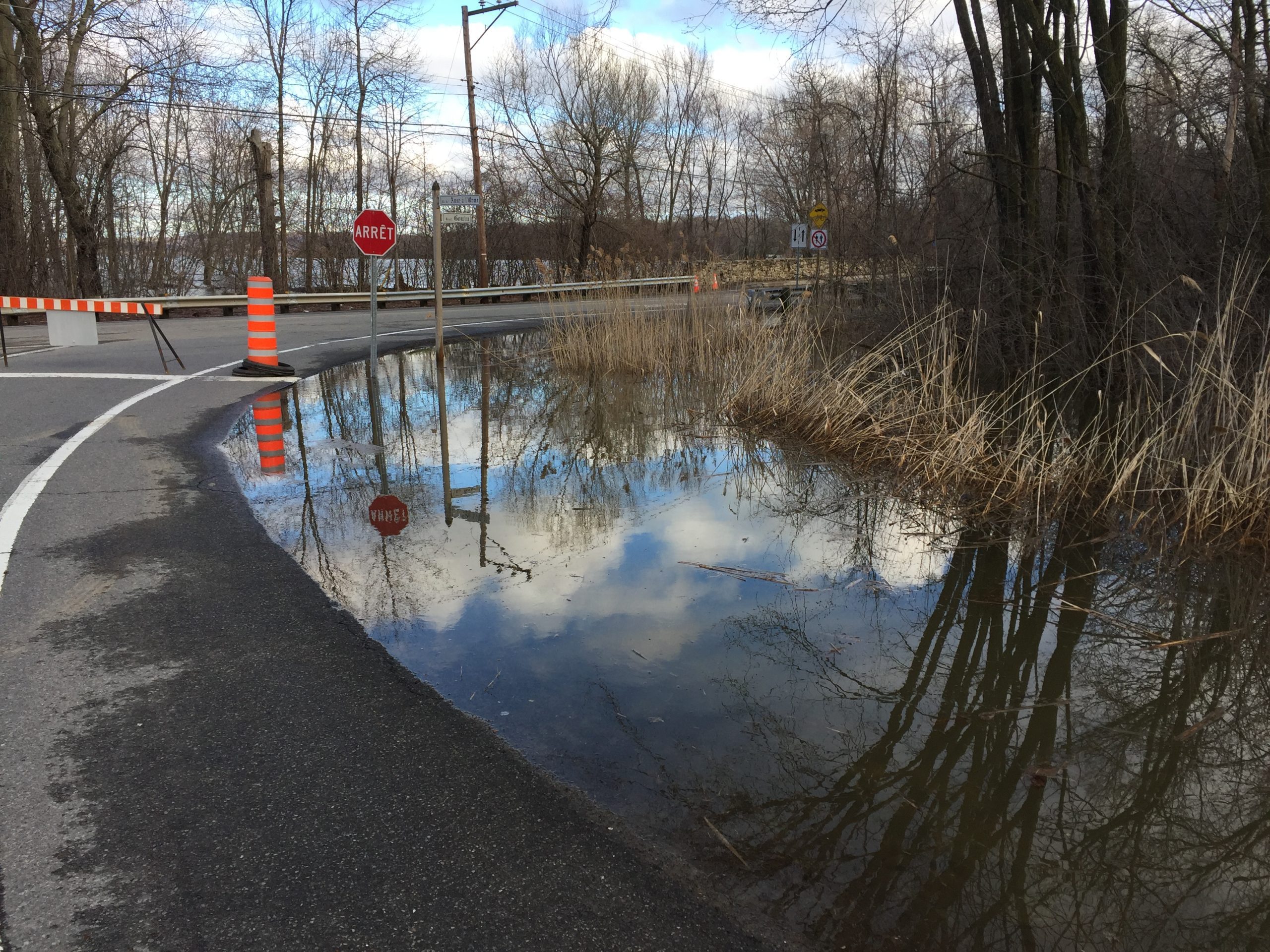
A flood occurs when an shoreline area is submerged because the volume of the body of water has surpassed the capacity of its bed. Major floods usually happen when snow melts in the springtime, during periods of heavy rain, but also in wintertime when frazil accumulates (see Types of Floods). A quick and major increase of the water level can also occur when a dam breaks.
Senneville is a municipality nestled by the Lac des Deux-Montagnes. As such, floods and Frazil Ice are one of the main natural hazards occurring on the territory.
During the year, flood forecasters monitor the amount of rainfall and snow and the impact on levels on rivers, lakes, creeks and streams.
Actual Situation update : Intervention 2
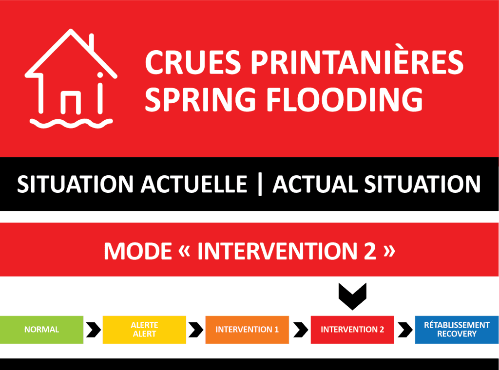
Last updated: May 12, 2025
Activation level
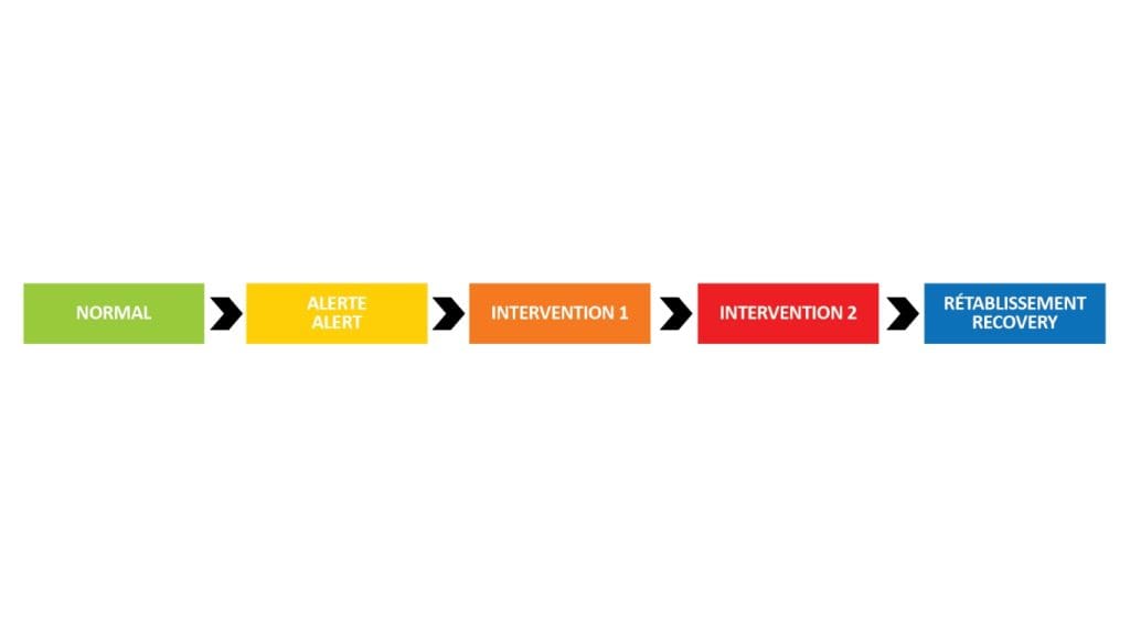
Normal mode
- Annually, as of March 15th, the Village of Senneville’s municipal services go into seasonal watch mode (on ground surveillance).
- Website: Regular updates
- Social media: Regular updates on Facebook (@villagesenneville)
Alert mode
- The Village of Senneville’s municipal services are going into “prevention” alert mode (increased ground and municipal facilities surveillance) and install activation level billboards throughout the municipality.
- Emergency measure newsletters via the Voilà! platform: Information sent directly to your email, subscribe here. A newsletter will be sent when water levels fluctuate.
- Website: Regular updates (warning banner activated)
- Social media: Regular updates on Facebook (@villagesenneville)
Intervention 1 and 2 modes
- CodeRED: Information sent regularly to red zone residents by phone, text message and/or email as preferred. Subscribe here.
- Distribution of sansbags and paper newsletters: In the “red zone” only
- Social media: Regular updates on Facebook (@villagesenneville)
- “EMERGENCY CALL CENTRE” line: 514-630-1234
- Emergency measure newsletters via the Voilà! platform: Information sent directly to your email, subscribe here. A newsletter will be sent when water levels fluctuate.
- Website: Regular updates
Owners must be proactive and are required to obtain the necessary equipment to protect their property. As a last resort, the municipality will have a limited amount of sandbags for properties located in risk areas. Note that this distribution is only made once the intervention mode is reached. BE VIGILANT! We invite citizens to remain vigilant and be prepared to take action.
Recovery mode
- Website: Regular updates
- Social media: Regular updates on Facebook (@villagesenneville)
- “EMERGENCY CALL CENTRE” line: 514-630-1234
- Emergency measure newsletters via the Voilà! platform: Information sent directly to your email, subscribe here. A newsletter will be sent when water levels fluctuate.
- CodeRED: Information sent regularly to red zone residents by phone, text message and/or email as preferred. Subscribe here.
- Distribution of sansbags and paper newsletters: In the “red zone” only
- Emergency measure installations set up by the municipality will be removed in recovery mode.
Water Flood Surveillance
Due to risk of flooding, several bodies of water are subject to continuous monitoring.
A body of water is flooded when its last measurement is above its minimum flood threshold (SIM)
Reference: Ministère de la Sécurité publique
Open data on water flows and levels
The measuring instruments installed on the rivers and reservoirs where we operate dams and power plants provide us with daily data on water flows and levels.
This data is now available to you through a simple tool! Check it out to find out about river flows and reservoir levels.
Video: Spring Flooding
Digital booklet